The Geographic Unit Relationships Dashboard visualizes the historical coverage of relationships between Geographic Units in the FEWS NET Data Platform.
This dashboard makes use of the relationships between Geographic Units in different Geographic Unit set versions as defined in relationship tables. In particular, this dashboard looks at well-defined relationships where there are direct relationships between two Geographic Units from different unit set versions, in which data can be aggregated from the newest to the oldest. Relationships that “break” the unit, such as redistributions, won’t be added to the Visualizations. Once the relationship is “broken,” data can no longer be aggregated from the current year to that year, or any previous year.
This dashboard is particularly useful in conjunction with historical analysis in the Crop Production Domain. This Domain makes use of Geographic Units for both spatial (admin 2 to admin 1) and temporal (old Admin 2 to new Admin 2) aggregation. That approach works for countries where we have well defined relationships covering all the Geographic Unit Set Versions for the period of interest but does not work well when that is not the case.
Options
Select a country
To use the dashboard, Select a Country from the dropdown menu. You can browse the menu or type in the box to search.
Select a year
The second and third Visualizations on this page default to the current year, in the case of the open-ended Geographic Unit set version, or to the most recent available year in the most recent Geographic Unit set version/shapefile. You can view data for a different year than the default by clicking the year on the timeline between the second and third Visualizations. The range of years on the timeline will change by country based on available Shapefiles.

Visualizations
There are three Visualizations on this dashboard:
-
Number of Geographic Units by year
-
Number of Geographic Units for selected year
-
Boundaries map
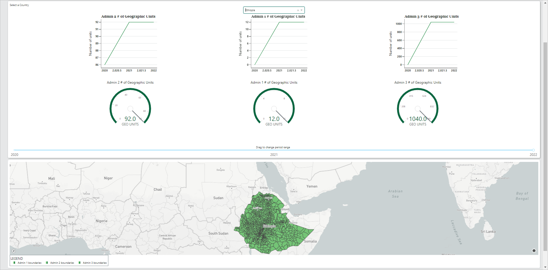
Number of Geographic Units by year
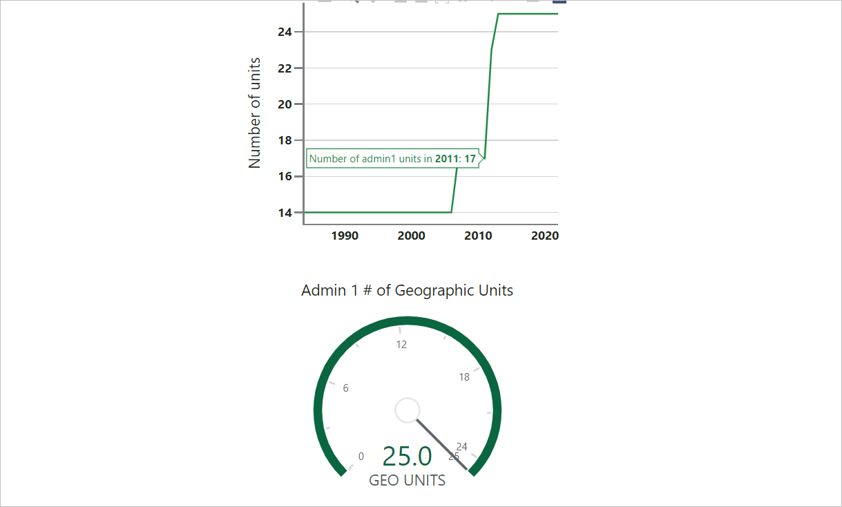
The first Visualization consists of one or more line charts that show the number of Geographic Units, by year, that have well defined relationships to the units from the current or most recent available Geographic Unit set version. Each available Administrative Unit level lower than 0 has its own line chart.
You can hover over the line in the chart to see the exact number of Geographic Units for a specific year.
Number of Geographic Units for selected year
The second Visualization consists of one or more dials that show the number of Geographic Units, for the selected year, that have well defined relationships to the units from the current or most recent available Geographic Unit set version. Each available Administrative Unit level lower than 0 has its own dial.
The maximum value of each dial represents the maximum number of Geographic Units available for that country at that administrative level. The green shading on the dial and green number indicate the number of Geographic Units at that administrative level that have well-defined relationships to the units in all versions from the selected year up to the current year.
Boundaries map
The third Visualization is a map that shows the boundaries of all Geographic Units counted by the dial in the second Visualization. Spatial data are not available for every country and year, even if relationships are well-defined. When that is the case that section will display the message No Available Geographic Data.
You can interact with the map in the following ways:
-
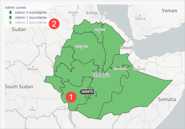
Hover over a Geographic Unit in the map to see the name of that unit.
-
Single click on a legend item to exclude it from the map or add it to the map.
-
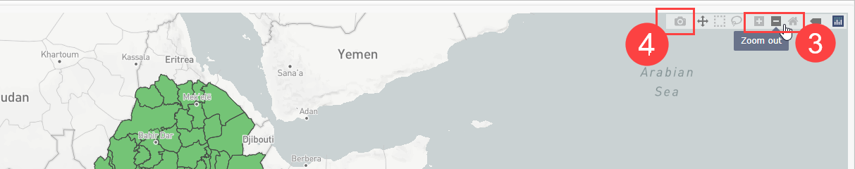
Use your mouse scroll button, or the zoom buttons in the top right corner, to zoom in and out. Double click on the graph background, or use the home button in the top right corner, to return it into the initial zoom state.
-
Click on the camera icon in the top right corner to download the map as a .png file.
Example
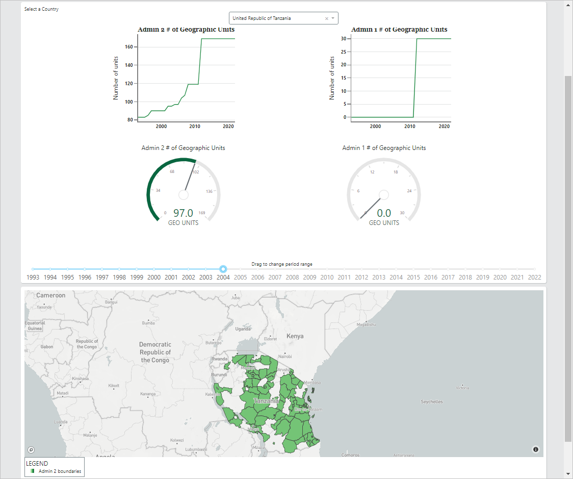
In this example, there is data available for the United Republic of Tanzania for Admin 1 and Admin 2 levels. Data in all 30 Admin 1 units and all 169 Admin 2 units are well-defined from 2012 to 2022.
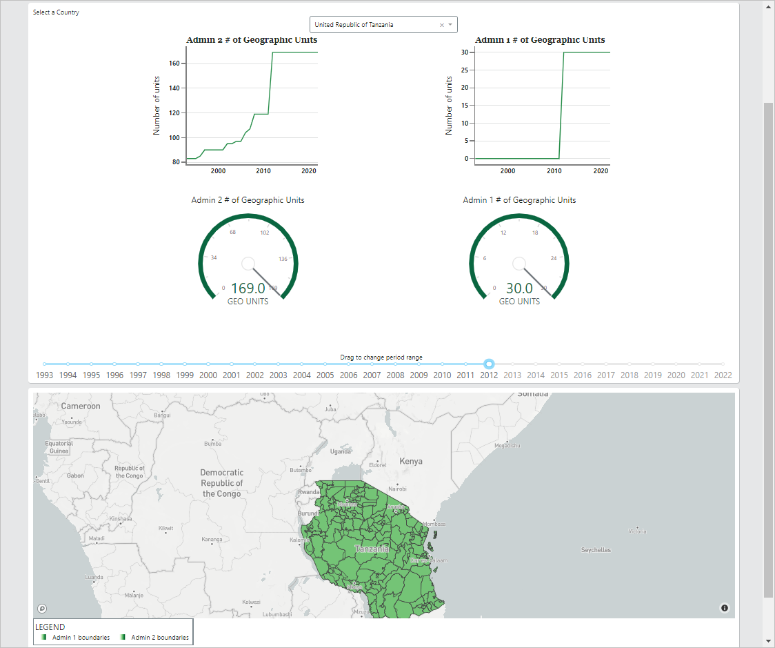
However, only 97 of the 169 Admin 2 units, and none of the Admin 1 units, are well-defined for every year between 2004 and 2022.